At the Crossroads in Susanville Ranch Park
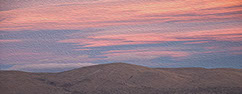
The best way to experience the landscape is to climb up into the foothills of the Cascades to one of the many vista points in the northern section of the park. Looking out across Susanville to the south, the Diamond Mountains rise up to the sky, abruptly marking the northern edge of the Sierra Nevada mountain range. If you get up there early enough, you will see the sun rise to the east over the Great Basin, the southern edge of the Modoc Plateau and the Honey Lake Valley. In this place -- often referred to as "California’s geographic crossroads"-- four distinct physiographic regions come together, blending into one dramatic view.
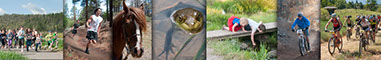
Park users will also find an amazingly diverse biological display while traveling the park’s trails. The riparian corridors along Bagwell and Paiute Creeks in the southern portion of the park contain the greatest biodiversity on the property with beaver ponds, willows, cottonwoods, watercress, amphibians, reptiles, small and large mammals, birds, and fish. There are dramatic stands of Jeffrey pine, dispersed incense cedar, fir, juniper and black oak trees covering the hillsides around and above the three open grass meadows in the park.
PDF Files
Geology Map
Ecoregions Map